5+ Hours Premium Video Content
Beginner Friendly
Resources & Practice Files included
Lifetime Access
English Audio & English Subtitles
5+ Hours Premium Video Content
Beginner Friendly
Resources & Practice Files included
Lifetime Access
English Audio & English Subtitles


Gain essential skills in site analysis mapping, learning key tools and techniques to structure and visualize complex data effectively.

Progress through hands-on exercises that introduce advanced mapping tools, refining your ability to analyze and present information.

Develop a clear, impactful approach to mapping, using strategic layering and design principles to produce compelling, professional-quality site analysis diagrams

- Illustrator Basic Tools
- Importing Maps
- Working on SVG & PDF versions
- Creating Clean Base Maps
- Illustrating analysis

- Multiple Diagrams Workflow
- Online Analysis Resources
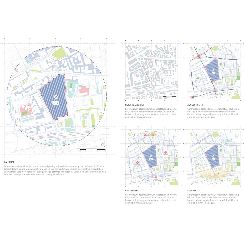
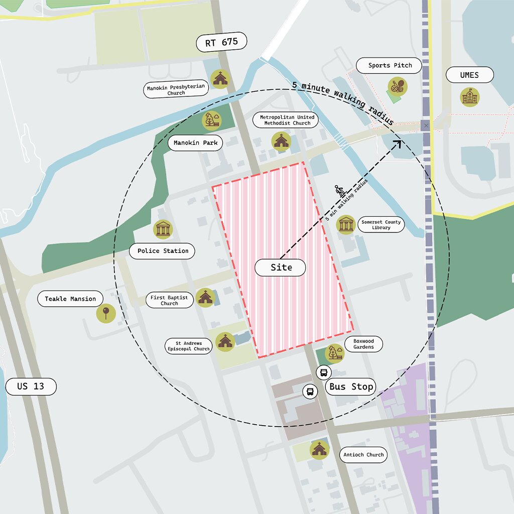
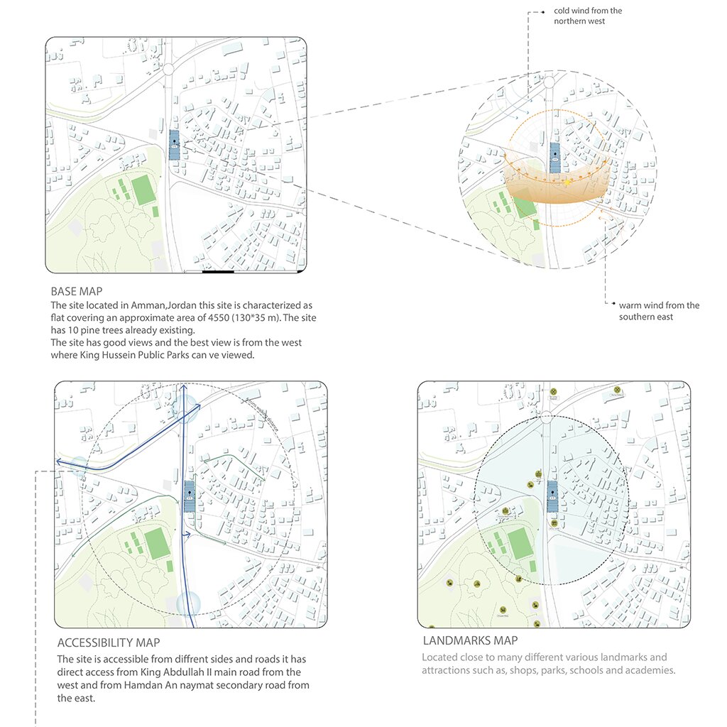
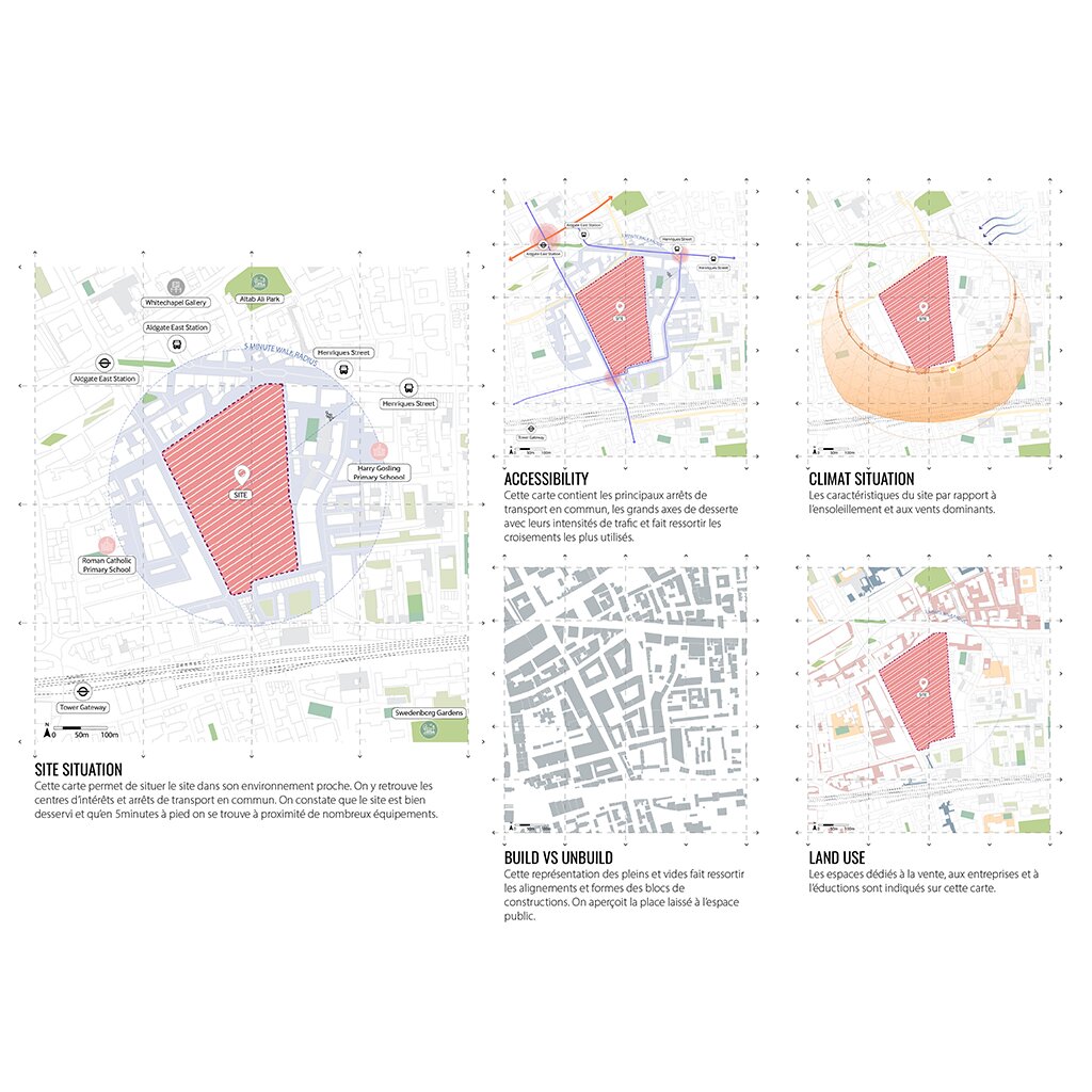
- Layers: Accessibility, Landmarks, Sun path & wind movement
- Adding Infographics

- Tools: Building Shadows,
Hierarchy of elements & Graphics - Create Exploded Isometric Map
- Exporting High Resolution Images


This course offers unlimited access and allows you to revisit lessons, empowering you to learn effectively even with a busy schedule.

This adaptable course lets you set your own pace and personalize your experience to maximize your learning.

Gain instant access to a specially curated site analysis graphic toolkit, a resource-packed PDF with links to online tools, and practice maps.

Our course includes practice files that allow you to experiment with techniques in real time. This hands-on approach lets you refine your site analysis maps.

This course equips you with efficient workflows for crafting high-quality maps saving you valuable time.

This course encourages active learning with exercises and feedback. Your efforts are recognized with a participation certificate that can enhance your online presence.
You’re new to Adobe Illustrator and want to learn essential site mapping skills.
You want to create clear, professional site maps for your projects.
You struggle to translate site data into impactful visuals.You aim to streamline your workflow and use Illustrator efficiently.
 Transform site data into compelling maps Learn how to visualize key site elements like topography, transportation networks, accessibility, and climate.
 Master various mapping styles Explore techniques for creating clean, professional maps, whether in vibrant color or sophisticated monochrome.
 Gain transferrable Adobe Illustrator skills Apply your knowledge to other conceptual graphics, from diagrams to presentations.
 Enhance clarity with effective layering Use graphical layering to structure information logically and improve readability.
 Enhance your workflow and graphic quality by mastering the right colors and styles, using 2D and 3D exploded layers effectively.
 Export high-quality, optimized maps Ensure your final outputs are polished, lightweight, and perfect for presentations or portfolios.


What does this course teach?
Do I need prior experience with Adobe Illustrator?
Will the course teach how to use online available data from Google in my maps?
Is this course relevant for urban planning or landscape architecture professionals?
Will I receive feedback on my work?
Will I receive a Certificate after I finish the course?
Any other question?
 Mastering Site Analysis Maps
This course is accessible, simple and well-structured. The instructions are clear, and the exercise is great for practicing. I learned lots of useful tips for my future projects, and it was fun to
Mastering Site Analysis Maps
Thank you so much for this course. I just wanted to share how much it’s meant to me, both personally and professionally. I’m currently a municipal planner, and one of my biggest goals this year has been to hone my digital drawing skills. This course filled in so many of those gaps for me and gave me the confidence to start integrating more visual storytelling into my planning Thanks again for such a thoughtful and inspiring experience.
Mastering Site Analysis Maps
I just wanted to extend my heartfelt thanks for your Mastering Site Analysis Maps class. It was incredibly insightful and well-structured. Your clear explanations and visual approach made complex concepts feel much more approachable.This class truly helped me understand and analyse my site better�both in terms of physical context and layered mapping.
Mastering Site Analysis Maps
This course is accessible, simple and well-structured. The instructions are clear, and the exercise is great for practicing. I learned lots of useful tips for my future projects, and it was fun to
Mastering Site Analysis Maps
Thank you so much for this course. I just wanted to share how much it’s meant to me, both personally and professionally. I’m currently a municipal planner, and one of my biggest goals this year has been to hone my digital drawing skills. This course filled in so many of those gaps for me and gave me the confidence to start integrating more visual storytelling into my planning Thanks again for such a thoughtful and inspiring experience.
Mastering Site Analysis Maps
I just wanted to extend my heartfelt thanks for your Mastering Site Analysis Maps class. It was incredibly insightful and well-structured. Your clear explanations and visual approach made complex concepts feel much more approachable.This class truly helped me understand and analyse my site better�both in terms of physical context and layered mapping.